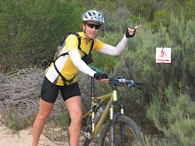
The recce is only a few days away and thank goodness for uncapped adsl and lots of phone minutes. All this technology at hand has made planning and communicating so much easier. We've spent hours pouring over maps and floating above the routes via Google Earth. The "route finders" have sent us as much information via gps as possible but not everything is known. There are so many enticing paths that look ideal but are very different on the ground. Last night, Doug and Glenn (the paramedic as opposed to Glenn the singlespeeder) and I spent several hours checking the route overlays on the 1:50 000 maps. And then there are last minute changes...like this morning. A local from Tzaneen, who spends plenty of time in our start village - Haenertsberg - can take us on a more direct route to the Wolkberg campsite. It involves some portaging but cuts out several hours of riding. And on a day that promised to be about 12 hours - that's good. Portaging that enhances the route is part of the adventure. Plus, we get to one of the prominent peaks in the area. I'm throwing out names of places here but over the next week, you'll get to understand how they all fit in as we relay our adventures over the net. Saturday we travel north which leaves me with two days to finalise everything even the last gasp training. Back to the web, google, email and cell phone.
Wednesday, September 15, 2010
Subscribe to:
Post Comments (Atom)


No comments:
Post a Comment